Slope Stability mapping
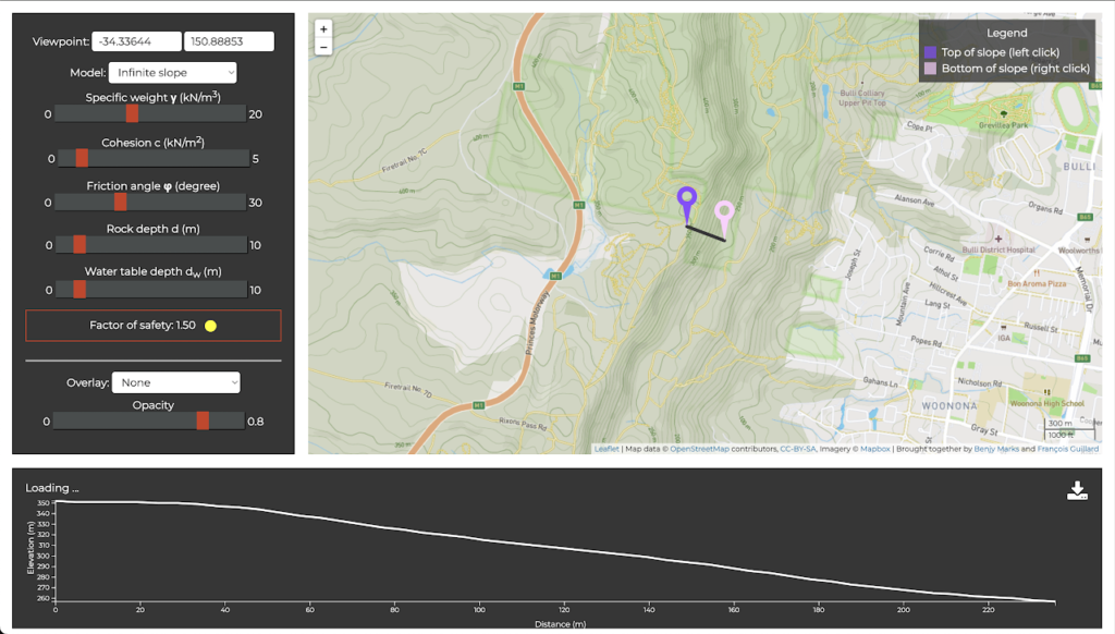
This mapping tool was developed to teach slope stability to undergraduate students in geotechnical engineering. It computes the factor of safety of a slope based on a few models and let’s the student play with the soil properties. The topography is served using a modified opentopodata server, serving data from Lidar, Copernicus, or SRTM database, depending on availability.
Resources
https://education.scigem.com/ : resources for learning and teaching.
https://github.com/benjym/mapping: Github repository of the project, including the modified opentopodata server.
Some nice topographic rendering using the python Inferno colormap


